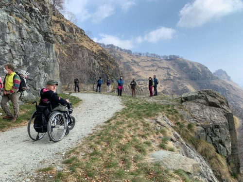
Touching the sky between pastures and moors, cliffs and overhangs. Walking along the routes of ancient trade and disused military roads, amid memories of emigration and cross-border trade, traces of fortifications and defence works.
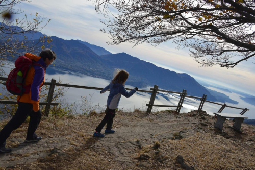
Curves and gradients, formidable scenery and landscapes: on foot, by bicycle or off-road, on Piedmont's Vie Storiche di Montagna (Historic Mountain Routes) one discovers uncontaminated environments where distant echoes of past events and memories resound. Places where it is not the destination that counts but the route, which in its deliberate slowness opens up to stories, signs of cultures and historical events.
Wonders immersed in imposing high-altitude landscapes, where silence is broken at times only by the sounds of nature or slow tourism.
Discover the itineraries of our territory!
THE HISTORIC MOUNTAIN ROAD "SIMPLON ROAD"
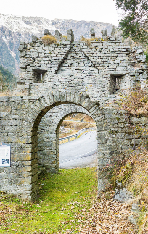
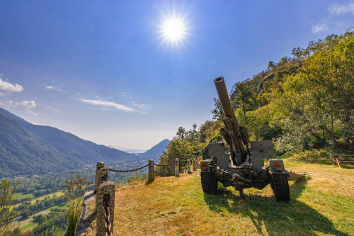
The Sempione Road is the tourist route that leads from Crevoladossola to the Simplon Pass at 2005 metres above sea level in Canton Valais (CH), one of the great Alpine routes of Europe. As proof of its strategic and commercial importance in antiquity it was a path, in the Middle Ages a mule track, in the 17th century a paved road, and in the 19th century a carriage road wanted by Napoleon Bonaparte as a connection between Milan and Paris, uniting Italy with the rest of Europe. In 1906, the Simplon Tunnel was also inaugurated, the 19.8 km railway tunnel that was an extraordinary work of engineering for the time and still represents an important cross-border connection for goods and passengers. In the period between the two world wars, important new defensive works were built along the Simplon Road in caves with numerous cannons, including the two Forts of San Giovanni, the Iselle Fort and the Balmoreglio Fort. CLICK HERE TO EXPLORE VIRTUALLY THE FORTS OF DIVEDRO VALLEY
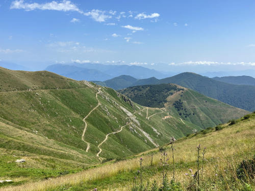
This route offers a number of interesting features: from the astonishing eight-metre width of the roadway even in the Alpine section to the original adoption of the parabolic arch to draw the curves, from the harmonious altimetrical modelling to the stone barriers. The Simplon Pass, conventionally the border point between the Lepontine Alps and the Pennine Alps, fascinates travellers because of the strong contrast between the steep walls of the Pale di Gondo and the immense vastness of the alpine pastures just beyond, with breathtaking views of the jewels of this corner of the Swiss Valais: the peaks over 4000 m and the Rhone valley that opens up far below, upon reaching the highest level of the route (21 km from the State Border - total height difference approx. 1750 m).
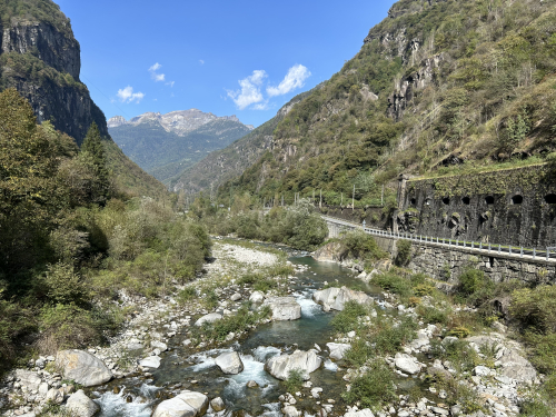
THE HISTORIC MOUNTAIN ROAD FROM THE TOCE WATERFALL TO THE SAN GIACOMO PASS
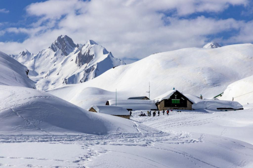
In northern Piedmont, on the border with Switzerland, Val Formazza is a paradise for nature lovers, hikers, cyclists. In winter it becomes a paradise for activities such as cross-country skiing, snowshoeing, ski mountaineering, downhill skiing, fat biking and much more.
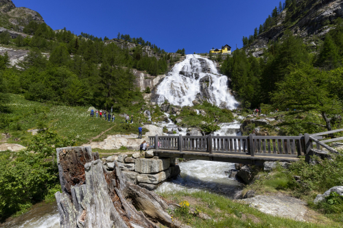
The symbol of the Formazza Valley is the Toce Waterfall, which, with its 143-metre-plus drop, is described as "the most beautiful and powerful waterfall in the Alps". It is here that one of the most fascinating historic mountain roads of the Distretto Turistico dei Laghi, Monti e Valli d'Ossola (Lake, Mountain and Ossola Valleys Tourist District) begins, built from 1929 onwards to allow the construction of the Castel Lake and Toggia Lake dams. The road continues to the San Giacomo Pass, thus connecting Italy with Ticino Switzerland.
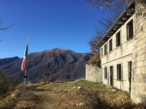
This route, overlapping only in the initial section with the Valle Formazza state road 659, leads to the hamlet of Riale di Sotto. Shortly before reaching the hamlet of Riale (1740 m asl), the route branches off and here begins the dirt road that leads to the Maria Luisa Lodge (2160 m asl), and then on to Lake Toggia and the San Giacomo Pass (2313 m asl). In the section between Riale and the Alpe Toggia basin, the road becomes a true masterpiece with gentle slopes and hairpin bends with perfect lines, flanked by stone walls and arches from which you can take unique photos of the valley and the peaks of Alta Formazza. The final destination is the San Giacomo Pass, from where there is a beautiful view over the Bedretto Valley (Switzerland). As early as 1885, there was a small Swiss shelter on this pass, where telegraphists transmitted the transit situation in Alta Val Formazza to the fort in Airolo (Switzerland). Following the construction of the carriage road to the Italian side of the San Giacomo Pass, new fortifications were built on the territory of Val Bedretto in the 1930s, which became the heart of the local defence system: the "Grandinagia" artillery fort and the "San Giacomo" armoured blockhouse, machine-gun and artillery emplacements, shelters and cable cars for logistics and supply to the main forts.
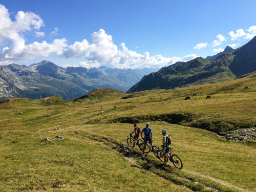
Today, this dirt road is practicable on foot and by mountain bike, as it is also a section of the Interreg Italy-Switzerland Lakes & Mountains Bike Project. For winter and snow lovers, the way is clear for snowshoes and mountaineering skis (remember to always consult the avalanche bulletin and carry the PSA kit).
The village of Formazza is also a picturesque, scattered hamlet, featuring typical Walser dwellings built from the 13th century onwards by settlers from the people of the same name who, coming from the nearby Goms Valley in Valais Switzerland, moved to this valley.
THE HISTORIC MOUNTAIN ROAD "CADORNA LINE"
In the Bassa Ossola you come across another famous historic mountain road in the Distretto Turistico dei Laghi: the famous Cadorna Line. This defence system was built near the Swiss border during the First World War at the behest of General Luigi Cadorna, then Chief of Staff of the Army, who feared an Austro-German invasion through neutral Switzerland.
This immense defensive structure, built between the spring of 1916 and the spring of 1918, stretched across Piedmont from Ossola to Verbano to Lombardy, creating a dense network of military roads and mule tracks, trenches, artillery positions, small hospitals and logistical facilities, barracks and lookout points. The work was carried out by local masons and stonemasons. Women also played a fundamental role in the construction of the defensive line, especially in the transport of material and supplying the construction sites. The Cadorna Line was never actually used for war purposes and today this military road is a historical heritage that allows the community to learn about a moment in the history of the 20th century. It is also a naturalistic resource for trekking and mountain-biking enthusiasts, offering routes that can be travelled almost all year round (be careful in the event of recent snowfall).
The Cadorna Line: from Ornavasso to Fort Bara
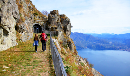
A well-preserved stretch of mule track of the Cadorna Line begins in Ornavasso, a municipality of the Bassa Ossola of Walser origin, at the parking lot of Punta di Migiandone (210 m asl). Steep hairpin bends flanked by stone walls lead to the Bara Fort. Along the way, you will encounter tunnels carved into the rock, trenches, walkways and machine gun emplacements (it is useful to have a torch with you). This mountain ridge was the optimal place to control the passage between the Bassa Ossola and the Maggiore and Mergozzo Lakes at the narrowest point of the plain of the Toce River, called precisely the "Stretta di Bara". Arriving at Fort Bara (410 m asl) one can admire a fortified multi-level emplacement consisting of several embankments supported by square stone walls, which would have housed barracks and long-range cannons to protect the Ornavasso and Migiandone system of trenches. Cannons and mortars make this visit even more evocative.
The Cadorna Line: from Pra' Michelaccio to Montorfano
From Fort Bara, attention is captured by Mont'Orfano or Montorfano (794 m above sea level), which, thanks to its isolated position, was considered an important strategic place from which to dominate the surrounding territory, from Lake Maggiore to Lake Orta and Bassa Ossola. Various military constructions were built on the slopes of the mountain, which are still visible and can be reached thanks to a further section of the Strada Cadorna, a 4 km long and 4 m wide dirt road. The route begins in Mergozzo, in the hamlet of Pra' Michelaccio (204 m asl), following the signs for the military fortifications. The road, asphalted only in the first short section, becomes a nice dirt road that climbs for 4 km with a constant gradient and beautiful stone hairpin bends leading to the first Casermetta (Barrack). Continuing with a succession of beautiful military artefacts (retaining walls and water channels), the road reaches the second Casermetta and the Polveriera (Gunpowder Store). The panoramic view from here is truly impressive. From the Polveriera you can continue on to the Cima del Montorfano (794 m asl - about 2 km). The dirt road becomes a mule track and then a grassy path and in about 45 minutes reaches other military works (shelters and barracks), whose construction involved the use of local natural resources including granite extracted from the nearby Cava Verde quarry at the foot of Montorfano.
The Cadorna Line: from Colle to Monte Spalavera and the Pian Vada' lodge
From Cima Montorfano, we can admire another stretch of the Cadorna Line: the route from Colle to Monte Spalavera and the Pian Vada' Lodge. We are in Alto Verbano and more precisely in Colle (1238 m asl), a hamlet of Oggebbio. Here, a convenient car park allows you to leave your car and begin the first ascent to Monte Spalavera (1534 m asl, a difference in altitude of approximately 300 m and a 2.7 km long route). The route follows a wide dirt track that then turns into a comfortable grassy path without any particular difficulty. The view ahead is truly spectacular, from the lakes to the peaks of the Val Grande National Park to the Monte Rosa chain and the Swiss Alps. When you reach the summit cross, a panel shows the profile of the Alps with the names of their peaks, and here you can admire well-preserved trenches. Returning to Colle, take the Cadorna Line following the signs for Passo Folungo. The road has a dirt surface and is about 13 km long. Along the way, you can admire the construction of a "Ospedaletto" (small hospital) and reach Passo Folungo (1369 m asl), where the Strada Cadorna begins to climb with beautiful hairpin bends up to the Pian Vada' lodge (1711 m asl, approx. 6 km - difference in altitude approx. 340 m). From here, there is a wonderful view of Lake Maggiore, the Intrasca Valley, the peaks of the Val Grande National Park and those of the Ossola region. Other fortifications can also be found at Monte Bavarione (1505 m asl) and Monte Carza (1116 m asl).
The Cadorna Line: from Piancavallo to Monte Morissolo
In the vicinity of Colle a Piancavallo (1247 m asl), there is a further stretch of the Cadorna Line, which on a beautiful dirt road, passing by the Auxologico Hospital, leads to the galleries of Monte Morissolo. The wide military road crosses an evocative beech forest and, coming out of the woods, offers a breathtaking view of Upper Lake Maggiore. A little less than half an hour's walk takes you to the galleries dug into the rock and to the cave posts of Monte Morissolo.
CLICK HERE FOR THE VIDEO 'Le Vie Storiche di Montagna in Piemonte' (Historical Mountain Routes in Piedmont)
CLICK HERE FOR THE VIDEO "Le Vie Storiche di Montagna tra le Valli Ossolane e i laghi dell'Alto Piemonte" (Historic Mountain Routes between the Ossola Valleys and the lakes of Upper Piedmont)
(The project is promoted by Regional Law No. 9 of 19 May 2021, "Interventions for the valorisation of historic mountain roads of tourist interest", which recognises and valorises historic mountain roads of tourist interest in order to promote the development of open-air tourism).
Ph. VisitPiemonte - I.ComMultimedia

Recommended
Inspiring ideas for unique experiences to live between our lakes and mountains!