A ring-shaped walk amid relaxing pastures in the Alpe Devero area, to discover the charming Lago delle Streghe, admire the lovely Lake Devero and explore the characteristic village of Crampiolo.
Departure and arrival location: Alpe Devero, area Ai Ponti (1640 m)
Maximum altitude: Montorfano-Lake Devero (1863 m)
Difference in altitude: About +300 m
Distance: 8,5 km
Walking time not counting stops: 2 hours and 30 minutes
Type of route: trail and dirt road
Signs: red/white road signs and wood signs
Water: fountains in Alpe Devero, Cantone and Crampiolo
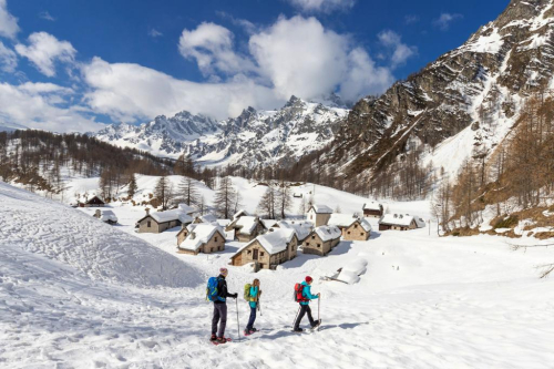
Recommended period: all year round. In late spring, to see the blooming meadows, in summer for the coolness of Lago delle Streghe, in autumn for the warm colours and the deer, and during winter for a quiet walk with snowshoes.
How to get there: it is 33 km from Domodossola. Go towards Crodo and then towards Valle Formazza to Baceno. Then follow signs for Devero (blue signs) and Parco Naturale Alpe Veglia - Devero (brown signs) for 12 km. Pay car park at Alpe Devero. By bus: Domodossola-Formazza line to Baceno (www.comazzibus.com) and between Baceno and Alpe Devero use the ProntoBus service (www.unionemontanaaltaossola.it).
Information: Distretto Turistico dei Laghi - www.distrettolaghi.it; Tourist Office Pro Loco Baceno - Via Roma 56, Baceno - tel. +39 0324.62579; Tourist Office - loc. Bagni 20, Crodo - tel. +39 0324.600005; Ente Gestione Aree Protette Ossola- www.areeprotetteossola.it; Municipality of Baceno - www.comune.baceno.vb.it; Unione Montana Alta Ossola - www.unionemontanaaltaossola.it
the itinerary
We are in the heart of the Natural Park Alpe Veglia-Devero.
In 1995, two park administrations consolidated: Veglia (1978, the first park in the Piedmont Region) and Devero (1990). The new park covers 86 square kilometres characterized by a typical alpine environment going from an altitude of 1600 to 3500 meters, even if the landscape has been modelled by people with gentle meadows surrounded by the harsh peaks. The park incorporates territories in the municipalities of Baceno, Crodo, Varzo and Trasquera. Veglia and Devero, which give the park its name, are the two largest alpine pastures in the Ossola Valley.
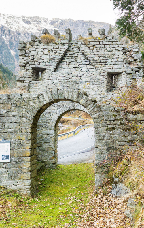
Start the walk by going between the houses of the hamlet on the beautiful cobblestone main street up to the 12th century Oratory of San Bartolomeo, then cross the bridge over Rio Buscagna.
If you like, you can change your plans by going to a large playground area on the left, delimited by this stream and Rio della Rossa. Just beyond, you will find the Museum of the Mountain Pasture (Museo dell’Alpeggio), housed in the ex-arrival station of the Goglio-Devero cable way (open in summer, info tel. +39 (0)324.72572). A cable way linked the two locations until the seventies. In 1939, this transportation line was opened to move materials and employees of Edison Volta (which became Enel). In 1944, a tragic event occurred when the Nazi-Fascists shot a machine gun at the cabin just after departure, killing four partisans. It was then used for tourism, and was closed when the asphalt road reached Alpe Devero.
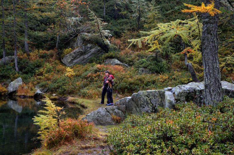
Just beyond the bridge, there is a white house with a sundial on it. If you look up, you can see the level that the snow can reach. Impressive! Ignore the road to the right and continue straight ahead next to the building with the bar and inn, following the red and white signs for "Lago delle Streghe 0.45". The path leads between relaxing open fields of Alpe Devero, on a stretch identified as being for everyone (“un percorso per tutti”), also accessible to strollers.
The large plateau was formed when an ancient glacial lake dried up long ago. In the Middle Ages, the area was still rather swampy but subsequent reclamation works have reduced the wetlands greatly, and widened the grassland and pasture.
Ignore the road to the right that runs slightly uphill, and take the path with practically no slope that leads to the village of Cantone (1640 m approximately), where you will also find the CAI Refuge. When you get to the first houses, turn right. The trail will begin to rise slightly (wooden signs). Just beyond that, abandons the dirt road and take a trail on the right (small sign for "Crampiolo-lago") that climbs a bit more decisively, bordered by vertical stones, and leads to an isolated mountain pasture (fountain). The trail becomes more gradual and continues through a pleasant small valley called Vallaro, delimited between meadows and trees and studded with large boulders that invite you to climb on them. There are also isolated houses of stone that appear suddenly, almost by magic, along the path, while the landscape slowly becomes more wooded and enchanting. A steeper and shorter path leads to just behind some houses in wood and stone.
Going to the left for about 5 minutes, you will reach the remains of an old limestone kiln located on the Nature Trail. These kilns were lit to cook calcareous rocks for a week, with flames which burned continuously so that the temperature could reach one thousand degrees centigrade. This is how they obtained "quicklime" that became "slaked lime” when mixed with water. Slaked lime was used in the building industry or, with the addition of a lot more water, "lime render", which has disinfectant properties and is used for whitewashing walls.
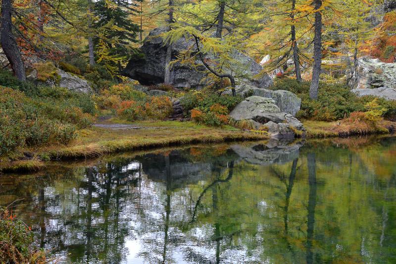
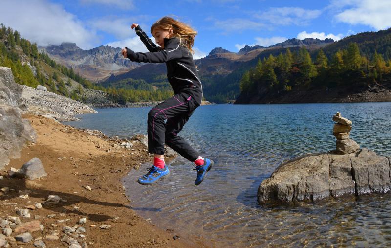
Go to the right (follow the sign for "Crampiolo 0.15") and after a few steps, leave the wide trail that goes directly to Crampiolo and take the smaller trail to the left (sign for "Lago delle Streghe") that rises decisively amid low junipers, blueberry bushes and rhododendrons. The climb takes little time, and soon the trail becomes more gradual even though almost closed by the vegetation. The appearance of the area makes the approach to the lake evocative, almost as if the witches have cast a spell to protect their lake. The body of water appears almost as a surprise among the dense vegetation. Now you are at the southern end of the Lago delle Streghe (1772 m), and a path on the right allows you to travel along the eastern shore, so as to arrive at the opposite end characterized by sparse marshy vegetation that does not grow tall. The path goes high enough with respect to the water level, a very good point of view to see the limpid waters gushing from an underground spring, to then descend to a bridge-catwalk that allows you to cross the wetlands and walk along a short stretch on the opposite shore up to a large boulder blocking the passage on the shore, near a squared stone at the foot of a niche that protects a sacred image. When you return to the bridge, continue along the trail to the left (wood sign for "Crampiolo 0.10"), and shortly you will reach the town. The road leads to the bridge over the Devero torrent, but do not cross it: continue along the dirt road keeping the water course to your right (follow the red and white sign for "Lago Devero 0.20"). Soon the dirt road becomes a very steep cobblestone road, and in few meters, it climbs and becomes a trail. It finishes right next to the dam of Codelago (1856 m.), overlooking the turquoise waters of Lake Devero, in the heart of the Natural Park Alpe Veglia-Devero.
The Codelago dam was one of the first in the Ossola region, erected between 1908 and 1912, thus raising level of the pre-existing lake by 20 meters.
After a stop on the lake shores to admire the peaks that surround and embrace the area in all their magnificence, follow the path along the top of the dam (the sign says "giro del lago"), and then go up the stairs and follow the path that passes behind and around the power plant buildings. Be careful at the first fork on the left, immediately after the plant buildings. The trail drops drops steeply toward the lake shore and there is a chain to help long a very short rocky passage that is not difficult (but watch small children carefully). Go along a short stretch along the lake and then come slightly away from the lake and go towards the partially abandoned town of Montorfano (1863 m.). Near the votive pillar, positioned on the top of the small promontory, you’ll have a magnificent view of the lake surrounded by mountains. After leaving the town, get back on the trail (signs for "Crampiolo via Dighetta") that skirts the top edge of the small recess of the lake located to the east of Montorfano, until you get to a smaller dam.
In 1921-24, the Codelago dam was raised higher, and this made it necessary to create a barrier to the east of the promontory of Montorfano, thus creating the Dighetta, or little dam.
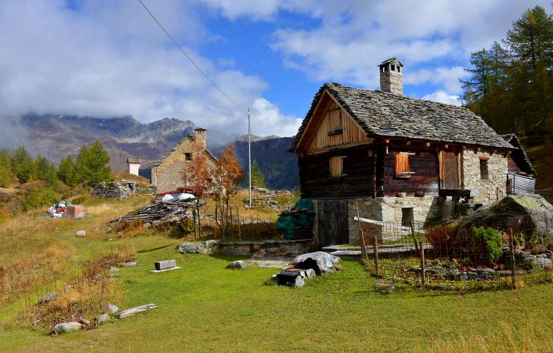
You can cross on its top and, when you get to the end, climb along the trail which leads to the dirt road that arrives from the circle road around Lake Devero. Now, take this road toward the right, with a slight continuous descent, and pass over another small dam. Without any other deviations, descend on a cobblestone and dirt road to the village of Crampiolo (1767 m) whose stone houses are grouped around the white Oratory of San Antonio Abate, built in the 17th century.
Here there are many places where you will be able to get something to eat or drink: agritourism places, restaurants, wine tastings and sales of typical products… Try Bettelmatt, a mountain pasture cheese already known in the 17th century.
After crossing the town, cross the Devero torrent on the wooden bridge and take the dirt road downhill (red and white sign for "Devero 0.25"), ignoring the first path to the right (which leads to the Lago delle Streghe) and turning left after about 300 meters on a wooden bridge (brown sign "Devero percorso invernale” (Devero winter path)). Go past the houses at Il Motto di Crampiolo (1770 m approximately) to follow a beautiful mule track in the woods that leads to the hamlet of Corte d’Ardui. Here, at the junction, continue to the right and always keep the Devero to your right as you walk along a relaxing woodland section where the trail descends gradually, with alternating sections of mule track and stretches of trail, until you return to Alpe Devero, thus concluding this pleasant ring hike.
Extension: with older children, it is possible to complete the hike around Lake Devero by travelling another 4.5km, +125m, in 2h. In this case, you do not pass on the top of the dam, but instead continue along the shore, with the water to your right (follow signs for "Giro del Lago"), passing through Alpe Codelago, the end of the Pianboglio basin, and then going back along the opposite bank. The track is part trail and part dirt road, with some passages that are a little exposed and on a cliff, with chains to help guide hikers.
to learn more
The Legend of the Lago delle Streghe ("Witches’ Lake")
A long time ago, there was a damsel who was in love with a young man who, unfortunately for her, had eyes only for another girl. One day, the unhappy girl was out wandering and she met an old woman sitting on a boulder, intent on spinning yarn. Looking into her eyes, the girl realised that the woman was more than what she appeared, and felt the need to tell her the sad story. Therefore, the damsel told the old woman of her anxieties, and implored her to cast a spell to make the young man love only her. The old woman tried to dissuade her, but without success. Then she agreed to work the spell, but on one condition: first the girl had to look at another man. They went into a cave, and deep within it was a warm and welcoming room, where there were two other witches. The old woman asked the damsel to look into two pools of spring water. In the first, she saw the face of her sweetheart but, as she looked, he became old and wrinkled, with white hair and yellow teeth. Horrified, the girl wanted to run away, but she also had to look into the other pool. There, she a handsome young man, as beautiful a god with loving gaze and the strength of a king. And she understood. In the first pool, she had seen human love, which is fleeting and short-lived, and can make one happy but not for ever. In the second pool, she had seen divine love that never ceases. The girl realized that this was what she really wanted, and thus began to dance with the other witches. The cave disappeared and the small pond grew so much so as to become a torrent and fill the plateau. Creating the "Witches’ Lake".
The Story of the Witches of Croveo
In reality, the area between Baceno and Croveo is sadly known for a real witch-hunt that occurred as the 16th century ended and the 17th century began. Dozens of women and even a few men were captured and killed, tortured and burned at the stake. According to historians, such fury was caused by the nearness to Switzerland, and the Calvinist faith, but others believe that it was the result of ancient pagan beliefs that survived due to isolation in the valleys. Whatever the truth may be, this remains a sad, dark event in the local history and religion.
The Devero Waterfall
The road to Alpe Devero (which can be driven on), travellers pass through a lovely tunnel dug in the rock. Just beyond after the tunnel, at a bend that turns to the right, they can see a superb view on the left of an impressive waterfall created by the Devero torrent. This spectacular sight deserves a stop in the parking areas located just before the hairpin bend. These parking areas are approximately 2.5 km away from the village, and are the last free spots available.
tips for young hikers
This walk, as we have presented it, is suitable for children of all ages. The only place where you must be very careful is the passage on rocks just before Montorfano. The complete trip around Lake Devero, in addition to this, may be long and suitable only for older children. However, these walks are not suitable for prams and strollers. In this case, it is better to stay on the dirt road that connects Alpe Devero to Crampiolo. If you like, and you want to push yourselves a bit, you can also reach Lake Devero if you follow the cobblestone road that runs alongside the torrent, on the orographic right side.
Slow trekkers: Franco Voglino, Annalisa Porporato and Nora Voglino
Authors of texts: Franco Voglino and Annalisa Porporato