DEVOTIONAL PATH: From Lake Maggiore to Val Vigezzo through the Val Grande
Note: To view the attached GPS map, install Google Earth (on both phones and computers) or an application that can manage maps and GPS tracks
Itinerary Description
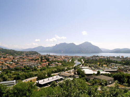
The itinerary runs along for a brief stretch the western shore of Lake Maggiore from Suna toward Fondotoce, continues within the Val Grande - through the Val Pogallo - and concludes in the Vigezzo Valley.
An important hub of the path is Cicogna, the "small capital" of Val Grande, establishing the boundary between human civilization and the civilization of nature: from this hamlet in the municipality of Cossogno, we cross Val Pogallo - one of the two main valleys of the Val Grande National Park - and we can reach Finero.
This is a trip into the history of Val Grande - among the beech trees, uncontaminated natural landscape and archaeologically significant sites - we finally reach Re, the heart of Vigezzina religious practices and final stage of the itinerary.
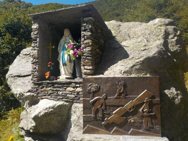
From Suna, we take a paved road in the direction of Cavandone that later becomes a comfortable mule track, which is the beginning an old path that - among woods of chestnut trees and scenic spots on Lake Maggiore - leads to the slopes of Monterosso. Along the path, there are several devotional chapels; a signal tower called "La Torraccia", probably built in the early middle ages; and at the forest's edge, the oratory of the Beata Vergine del Buon Rimedio.
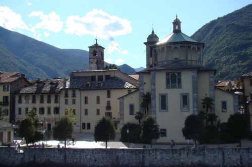
We continue along the paths, the "Sentieri del Monterosso", climbing with the trail to the town of Cavandone, a pleasant place with a number of attractions: the parish church of the Nativity of Mary, an ancient millstone, and a workshop where they manufacture of ceramics. Once past the town, the trail goes back along the main road, and we go towards Bieno, taking the secondary road. Travelling beside the river San Bernardino, we go towards Santino first and then towards Cossogno, which we reach by crossing the Roman bridge.
From here the itinerary continues along the ancient medieval road that connects Cossogno with Cicogna. We advance on a level looking section, and reach Miunchio and Ponte Casletto. A mule intersects with the road from Rovegro, and we reach Cicogna, a village that separates the beginning of Val Pogallo from Val Grande.
A small detour to the west, along a paved mule track, leads us to Alpe Prà, an exceptional scenic point on Lake Maggiore and Orta and the surrounding mountains.
We get back on the trail and begin out journey across the Val Pogallo. The itinerary then continues under the beech trees - which have made a majestic return after the deforestation of the beginning of the 1900s - and ancient transits of shepherds. Travelling on the shore of Rio Pianezzoli, we reach Pian di Boit and Alpe Terza, on a path that climbs up through a steep forest: we continue to Bocchetta di Terza and then go down in the valley of Finero. After we have reached Alpe Prebusa, continuing along the trail immersed in the beech wood, we cross the river at Provola come to Finero.
The road that joins Cicogna and Finero through Val Pogallo is called "of the Pilgrimage", and has been travelled by many pilgrims, as well as smugglers and partigiani.
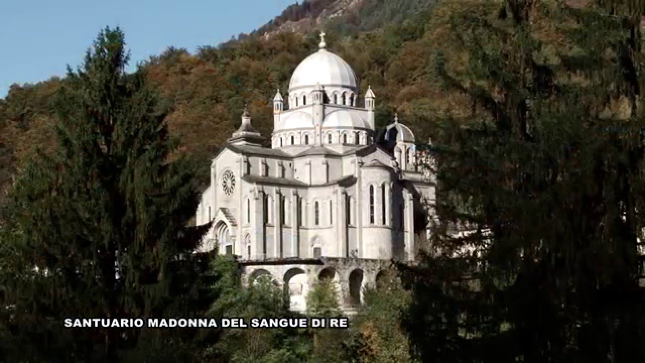
After going through the village of Finero, we abandon Val Grande and enter Val Vigezzo: the path continues to the WWF Natural Oasis of Pian dei Sali and finally on to Re, where the Sanctuary of the Madonna del Sangue is our destination in this devotional itinerary.
POINTS OF INTEREST
Cappelle devozionali lungo i Sentieri del Monterosso
Oratorio della Beata Vergine del Buon Rimedio
La Torraccia
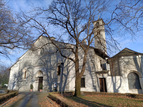
Chiesa Parrocchiale della Natività di Maria
Parco Nazionale Val Grande
Centro visita di Cicogna
Ponte romano
Oasi naturale del WWF di Pian dei Sali
Santuario della Madonna del Sangue
FACILITIES
RIFUGI IN VAL GRANDE
ALTRE STRUTTURE RICETTIVE
FOR MORE DETAILS
www.parcovalgrande.it
TECHNICAL NOTES
LEGS: the journey is recommended in three legs - from Suna to Cicogna (km 16), from Cicogna di Alpe Pian di Boit (km 11,5), and from A. Pian di Boit to Re (km 13)
DIFFERENCE IN ELEVATION: lowest altitude of the itinerary, 200 m a.s.l.; highest, 1845 m a.s.l. See the map.
DURATION: from 3 to 6 hours for each leg
TYPE OF PATH: Hiking - PREVALENCE DIRT ROADS
TOURIST INFORMATION
Distretto Turistico dei Laghi, Monti e Valli d'Ossola -
www.distrettolaghi.it
tel. +39 032330416/fax 0323934335 infoturismo@distrettolaghi.it

Nearby
Discover places, experiences and activities in nearby locations