A challenging semi-circular excursion that leads through dense woods and charming abandoned villages to a 360° balcony over the northern part of Lake Maggiore and the Cannobina Valley.
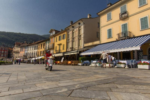
Departure location: Sant'Agata di Cannobio (450 m)
Place of arrival: Monte Giove (1298 m)
Difference in altitude: 850 m total
Distance: 9 km total
Walking time not counting stops: 4 hours and 30 minutes total
Type of route: mixed (trail, asphalt, dirt road)
Signs: red/white "Monte Giove" signs; red/white marks; signs for "Biessen" and "Sant'Agata"; old yellow/red marks
Water: fountains in Sant'Agata
Recommended period: all year round, without snow
How to get there: the trail starting point is in a village located 38 km from Gravellona Toce. SS34 towards Verbania/Locarno. After the village of Cannobio, turn left towards Ronco and Sant'Agata. A large car park is on the left just before the village. By bus: line 17 Cannobio-Sant'Agata (www.vcotrasporti.it).
Information: Distretto Turistico dei Laghi www.distrettolaghi.it; IAT Office - Largo alla Chiesa 3 c/o Palazzo Parasio, Cannobio, www.procannobio.it; Municipality of Cannobio www.comune.cannobio.vb.it
the itinerary
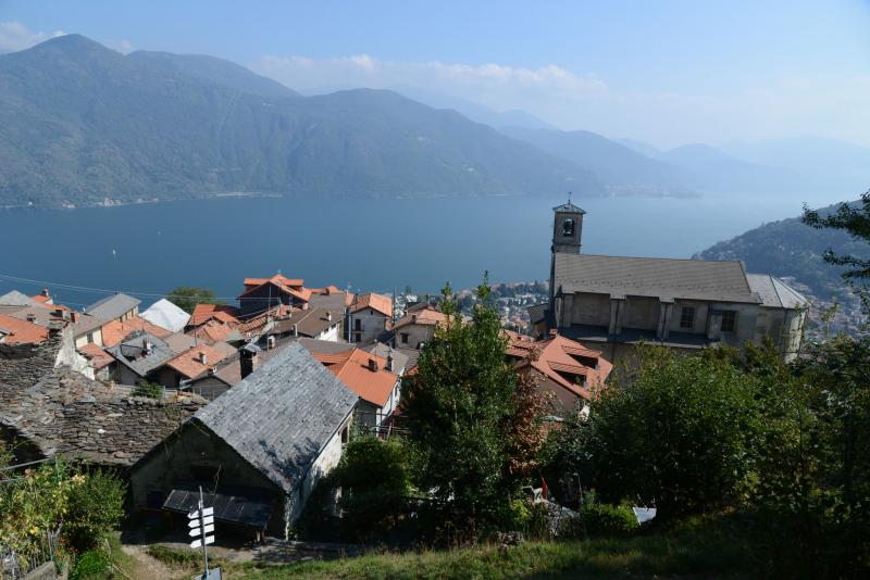
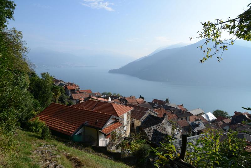
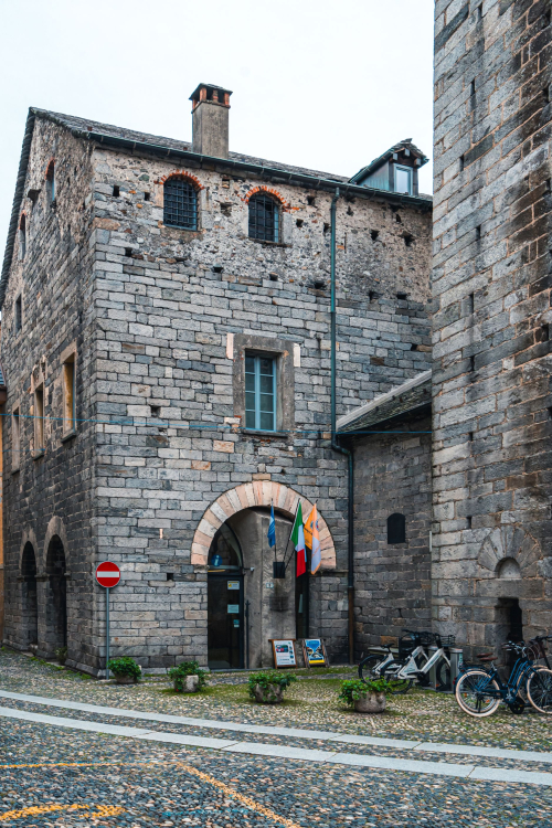
The village of Sant'Agata overlooks the village of Cannobio, and gives excursionists a beautiful view of the lake before they even begin walking. From the car park, take the pedestrian road at the end that is closed by a barrier (a blue pedestrian sign says "strada privata" (private road) and there are red/white marks). It leads towards a grassy track and then a path that passes the elementary school to get to a paved road. Go towards the church, which you will be able to see, and you will come to a magnificent balcony overlooking the lake (with a water fountain, rest rooms and a coffee shop). Pass in front of the church and walk under the arch. Continue through the maze of alleys in the village, following the round red and white marks until you reach the end of the buildings where you’ll take the path uphill on the right (sign for "Monte Giove"). A rather steep climb through chestnut and oak trees takes you quickly to the small chapel of S. Luca (687 m) immersed in the woods. Continue to the left. The path is still climbing, but now a little more gradually, as it leads into a beautiful terraced area where ruins appear at times. Just after the remains of a village, you’ll get to a fork. Bear to the right and follow the sign for "Monte Giove".
Note: Remember this spot because this is where the circular path ends up on the return trip.
Continue uphill again through the woods until you reach a paved road. Take this road to the left, uphill, but almost immediately you’ll leave the asphalt and take another path on the left that leads to Marcalone (860 m). This village has a marvellous view of the lake, and it can be considered a destination in its own right because it offers meadows where you can play and an agritourism business.
Note: you could also drive up to this location, but keep in mind that the road is quite narrow.
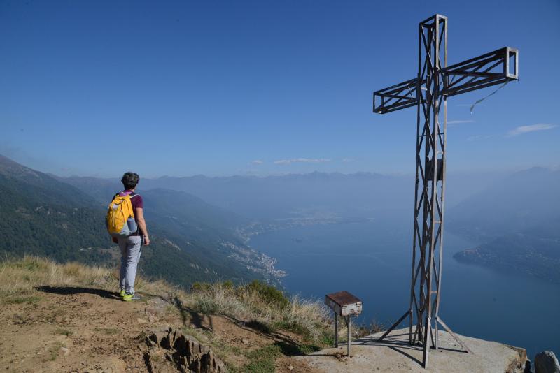
When you reach the houses, take the left staircase ("Monte Giove") that leads through the entire village. When you get to the asphalt, cross it and take the path (sign for "Monte Giove"). A little further on, there is a fork in the path, with red and white markings on both paths. It’s best to keep right and stay on the widest path with the most recent rectangular signs. The forest is now made up of thick spruce trees. When you reach the asphalt road, follow it uphill to the right. You’ll come to the first of three paths leading off the road to the right, which makes a short curve (but is not worth following). The second path goes to the left but will not save you much time. Take the third path leading off the asphalt to the right because it shortens the road a lot, even though it takes you up a steep climb through the spruces (pay close attention to the round red and white marks because it is easy to get on the wrong path). When you are back on the asphalt road - which at this point will turn into a dirt road - continue to the right, always uphill, and watch the vegetation change and open up amid the birches. You’ll come to a fork between the dirt road and a path to the right, both with signs for "Monte Giove". Both directions are correct, but we suggest you stay on the road because - at the time of our inspection - the path was not in very good shape. Also, staying on the road ensures a circular route. The dirt road climbs gradually and then makes a hairpin bend. Take the path on the left (wooden sign) and start up the last climb. Now, you are in an open panoramic environment, on a path that leads to the peak, where you will find a cross and an artistic bench dedicated to variants of the name Jupiter (Giove). After admiring the full 360° view, hikers can start down the wide grassy track on the opposite side of the hill with respect to where they came up. The track soon becomes a rapidly descending path amid short birches that then become increasingly large with beautiful ferns growing underneath. You will come out on a dirt road, and you must go to the left on a light downhill incline until you reach a crossroads. Turn left in the direction of the tables (sign for "Biessen") along the grassy road that goes to the village of Rombiago (1167 m). Just before getting there, you’ll descend along the path on the left (signs for "Biessen"). Be careful because this part of the path is hard to see and it is easy to get on the wrong track: do not walk parallel to the village, but instead go down through the birches and then you’ll find the path to the left (old sign for "Biessen"). The descent will be continuous and constant, indicated by old yellow-red marks, first among the birches and then amid the chestnuts and oaks. When you come to a small group of houses, and you will find a fork in the road. Go to the left (sign for "Sant'Agata"). The path winds along gradually. After an isolated votive pillar, it is rather exposed - there is sheer drop over the Cannobina Valley below - but it is not dangerous.
Note: if you look down to the right you can see the seventeenth-century Church of St. Anne positioned on a gorge dug by water, spanned by a small medieval bridge.
The path continues in a gradual descent, and leads to the ruins of the village you saw on your way up. From here, follow the downhill trail to the chapel of S. Luca and then continue the steep descent to return to the starting village, Sant'Agata.
tips for young hikers
A long excursion, this hike is absolutely recommended for its beautiful scenery, but it is only suitable for older children who are already accustomed to walking.
Trail creators: Franco Voglino, Annalisa Porporato and Nora Voglino
Content authors: Franco Voglino and Annalisa Porporato