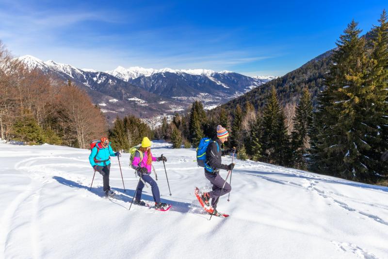
A hike through a beautiful beech forest to a magical frozen gorge and then up to the gentle, panoramic plateaus of the summer alpine pastures at the foot of Pizzo Ragno
Place of departure: Druogno, locality Orcesco (814 m.)
Place of arrival: Alpe Campra (1379 m.)
Height difference: +570 m one way
Distance: 3.5 km one way
Travel time net of stops: 2 hours 45 minutes one way
Signage: signs "A. Campra M06" and white/red signs
How to get there: 14 km from Domodossola. Strada Statale 33 del Sempione exit Masera. Follow the signs for Strada Statale 337 della Valle Vigezzo and then take the diversion for Gagnone - Orcesco.
The itinerary:
From the car park near the Gagnone-Orcesco station, walk towards the village, crossing the railway line and continuing straight on along Via Adorna. Following the beautiful paved road, the route continues uphill into Orcesco, passing the oratory dedicated to San Carlo. At the end of the built-up area, you join the road open to traffic and after a few steps you come to a playground near an isolated building (locality Crotta). From this point, it is possible to wear snowshoes as the trail is no longer cleared.
Just after the playground, turn left uphill (signpost) along the treeless strip that climbs steeply until it crosses a road. Go straight on past it (signpost) and cross a beautiful and evocative beech forest. There are not many signs, so keep your eyes open!
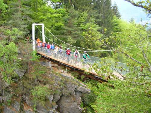
After reaching a bench, the trail turns to the left, well-marked by a handrail, as it runs along the Rio Lupo stream leading to a beautiful wooden bridge. A magical spot where winter ice creates spontaneous sculptures.
After the bridge, the ascent continues, always among the beech trees that let in light and air, in a steady, continuous climb that leads to a bend in the road and then crosses an area where, unfortunately, a storm has felled many trees.
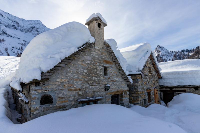
Cross a forest track to continue on a steep climb that leads to the road. Follow the road uphill to the left and, when you reach a bench, leave it and take the path to the left, climbing again through the trees until you reach a recently restored isolated building.
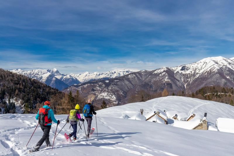
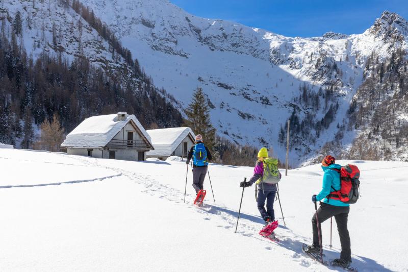
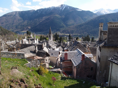
Go past it to climb along the open meadow leading to a panoramic balcony overlooking the Vigezzo Valley and the ruined buildings of Alpe Motta. The route levels off to the left and after passing a gate leads to the wide plateaus at the centre of which are the buildings of Alpe Campra, divided into two small groups, with a small and isolated oratory between them. Looking up, the mass of Pizzo Ragno rises, while on the opposite side the peaks of Monte Leone and Monte Cistella open up.
The open spaces lend themselves to free roaming, for example climbing up to the old wooden cross from which there is a beautiful view over the entire plateau and on Alpe Campra at the foot of Pizzo Ragno.
The return journey is by the same route as the outward journey.
Alternatively, back at Alpe Motta, it is possible to ignore the descent over meadows to keep level, pass the buildings and reach the road. Following this route, you will face a lower gradient, although it will lengthen the trip by about 2 km.
Tips for baby snowshoers
Excursion for grown-up children and children used to walking, although the variety of landscapes makes snowshoeing easier. It is better not to start too early, as the route is mostly in the shade and the winter sun only arrives at Alpe Campra around midday. The ice bridge is magical, a destination that is also accessible to children (+100 m difference in altitude, 1.2 km, 30 minutes).
CONTACTS FOR TOURIST INFORMATION
TOURIST OFFICE OF DRUOGNO
Piazza della Chiesa - 28853 Druogno (VB)
Tel. +39 0324 93565 - +39 340 8682308
Email: turismo.druogno@libero.it
COMUNE DI DRUOGNO
Piazza Municipio 3 - 28853 Druogno (VB)
Tel. +39 0324 93071
protocollo@comune.druogno.vb.it
www.comune.druogno.vb.it
Path makers: Franco Voglino, Annalisa Porporato e Nora Voglino
Author of the text: Franco Voglino, Annalisa Porporato
The path is described in the book “SNOW TREK” of Distretto Turistico dei Laghi – edition 2021
The routes were suggested by ski operators and municipalities Partner of Neveazzurra project. We decline any responsability regarding the effective feasibility and any changes that the routes can suffer. Maps and tracks are purely indicative of the route.
Safety annotations:
Here are some practical tips: find out about weather and snow conditions, checking the forecasts especially at local level; check the avalanche bulletin for the relevant area; equip yourself with and carry PSA self-rescue equipment: shovel, probe and ARTVa; wear warm, waterproof clothing that is comfortable and consists of several layers... despite the snow, you will get warm as you move; hiking shoes or mountain boots depending on the area, terrain and altitude where the hike takes place; bring gloves, cap, sunglasses and sunscreen; pack a rucksack with a spare shirt and hot drinks; during the hike, always check the slopes above you; avalanches usually break off on slopes with a gradient of more than 25° and can also continue on flat sections.