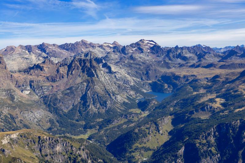
The Ossola Valleys
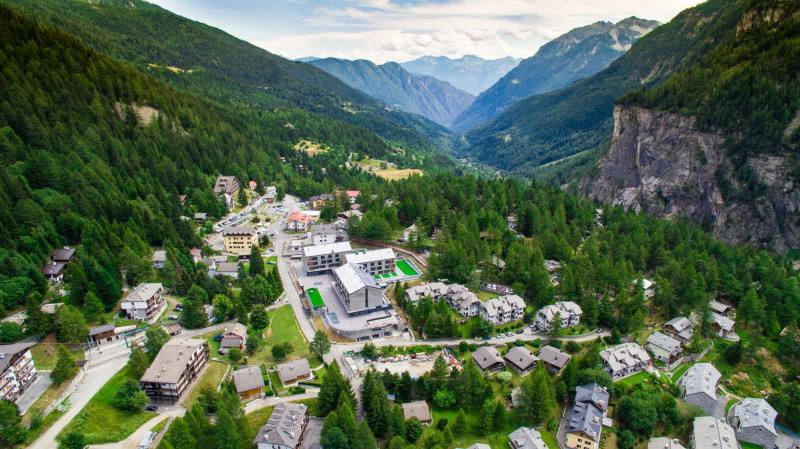
This is Ossola, so close to the Swiss border and yet, so Italian as shown by its attractions, typical cuisine and tradition.
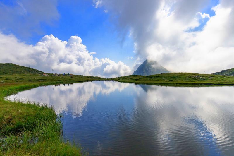
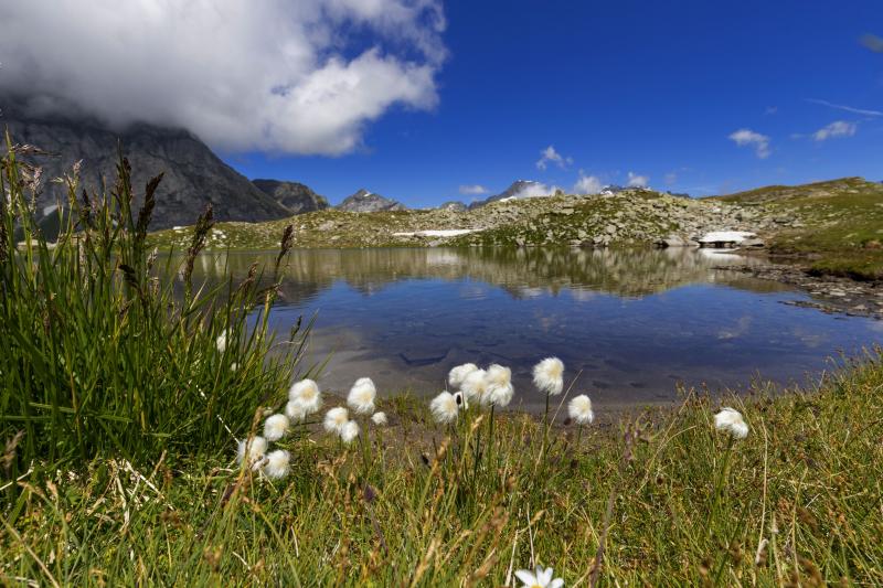
Here Nature is in any way the absolute protagonist: alpine lakes, parks, forests and white slopes contribute to shape the rich landscape.
The Val Grande National Park, the most extensive Wilderness Area of the Alps (about 15,000 hectares) is enclosed between Lake Maggiore and Ossola, that is the Val Grande National Park. The European Wilderness Association declared the only area in Europe that completely maintains original environmental properties.
The second highest European summit, Mount Rosa, represents the real jewel of the Anzasca Valley. From the Bognanco Valley, also known as the “valley of 100 waterfalls”, a paradise for canyoning and hiking lovers, to the Antrona Valley, lately declared Regional Nature Park, and the Antigorio-Divedro-Formazza Valleys, with the famous 143 mt high Toce Waterfall: a definitely dreamlike combination for a holiday immersed
in the most uncontaminated nature. Discover the green, pure and wild Ossola and enjoy a 360° mountain experience!
The Antigorio Valley and its charming and ancient views
Heading down from the Formazza Valley it is possible to reach – due south – the Antigorio Valley.
Here nature offers spectacular views created by water throughout the centuries: The Gorges of Uriezzo are the most famous ones: deep and tortuous canyons dug into the rock by the action of glaciers and streams over the centuries (including the water of the Toce River). It is possible to visit the gorge on foot (easily in the periods with less flowing water) and admire their steep and snaking walls. In Premia, at Uriezzo, there are the equally spectacular gorges of S. Lucia of Balmasurda and Arvera. In Croveo, a Baceno hamlet, it is possible to visit the Marmitte dei Giganti, fascinating circular-shaped erosions in the rock, splendid inlets and hemispherical rocks dug by the force of water.
The Antigorio Valley is entirely crossed by the Toce River and extends from Domodossola to the hamlet of Chioso di Premia, including the municipalities of Crodo, Baveno and Premia. Its extension to the north forms the Formazza Valley, while from Baceno the Divedro Valley opens to the north-west, from which it is possible to reach Alpe Devero.
The ancient Walser village of Salecchio (1,320 meters above sea level) and the Parish Church of San Gaudenzio in Baceno, which rises majestically on the rocky spur that overlooks the Orrido di Silogno, right in the center of the village, deserve a special mention. The importance of the village increased during the thirteenth century, a period in which several changes were made to the parish church documented already in 1039, when the building consisted of a chapel then incorporated in the twelfth century version of the church and now forming its central nave.
The Bognanco Valley, among emerald lakes and natural canyons
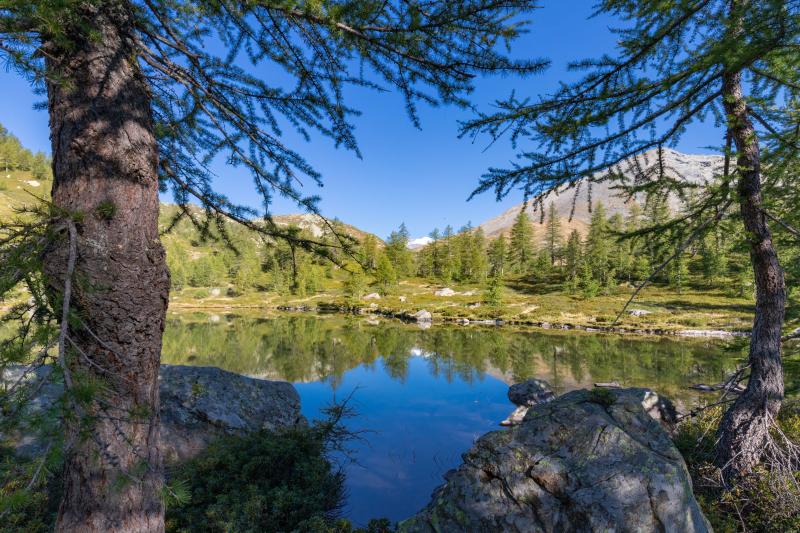
The Bognanco Valley offers many possibilities for hiking: the Fornalino, Cima Verosso, Gattascosa, the 3 lakes of Paione are some of them and are linked to each other. Through the Monscera Pass, an ancient smuggler road, you can often meet groups of tourists from Switzerland heading to Bognanco and Antrona. The itinerary that leads to the three lakes of Paione or to Pizzo Straciugo is well-known and popular, and from there it is possible to enjoy a spectacular view of Lake Maggiore and the Alps.
The excursions that lead to Alpe Gomba and Alpe San Bernardo are not particularly challenging but very charming.
The following ancient hamlets also deserve a visit: S. Marco with its little church dating back to the sixteenth century, Possetto with its mills featuring unique wheels, Pizzanco with its big chimneys and the ancient washtubs, Camisanca where there is the “Polveriera” – a fortress-house of the sixteenth century – S. Lorenzo with its parish church rich in frescoes and wooden furnishing, Gragna with its natural balcony from where it is possible to admire the entire panorama of the Valley.
The only municipality is Bognanco, a well-known holiday resort, spa and mineral water production center. The water of Bognanco was the first in Italy (since 1928) to be bottled with a fully automated process.
Therefore, with its 150 years of glorious hydropinic history the Bognanco Spa is a stop not to be missed. It allows the body to be rejuvenated in its swimming pool, sauna, turkish bath, emotional showers and – great news – the “SpaStream”, a horizontal massaging shower with 1200 jets.
The health resort of Bognanco is located at 700 meters above sea level and is 7 km away from Domodossola.
Vigezzo Valley: a thousand opportunities for walks surrounded by nature in full relaxation
The Vigezzo Valley, the only one of the seven Ossola valleys that extends from west to east, is located on a plateau of the Lepontine Alps at an average altitude of 800 meters above sea level. Lush greenery, forests, meadows, and alpine lakes offer a thousand opportunities for walks surrounded by nature in full relaxation.
The Vigezzo Valley, with its seven municipalities, is known as the “Artists’ Valley” for its ancient tradition of artists, portrait painters, and landscape painters.
Santa Maria Maggiore is the beating heart of the Valley, a delightful village particularly appreciated for its gentle plateau surrounded by vast expanses of conifers. The Rossetti Valentini School of Fine Arts is located here and the Chimney Sweep Museum that tells the story of the young Vigezzo inhabitants who left home and family to go out in the world in search of fortune, carrying out a difficult job. Craveggia is another charming place, a small village of peasant origin that turned into a real open-air museum, with elegant houses, picturesque fireplaces, decorations, and wall frescoes. And then Re, the devotional heart of the Valley with its majestic Sanctuary dedicated to the Madonna del Sangue. From Malesco you can reach the Loana Valley, the gateway to the Val Grande National Park, the largest wilderness area in Europe. At the same time, in Druogno the terraced fields of Coimo are particularly fascinating. Villette, which also houses a museum of alpine culture, is the village of sundials. These solar clocks marked the time for the entire community.
In winter, the Valley offers many opportunities for skiing enthusiasts thanks to various cross-country and downhill runs. Throughout the year, it is also possible to cross it on board the characteristic Vigezzina-Centovalli train: this is a railway line that, starting from Domodossola, crosses the Vigezzo Valley and the Centovalli to reach Locarno, in Switzerland. A fascinating journey on board a panoramic train to admire a mountain landscape gives lasting impressions in every season.
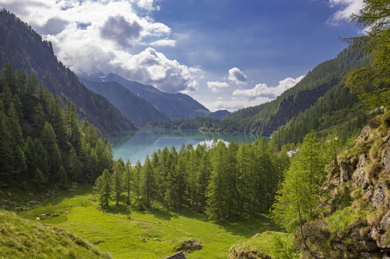
Formazza Valley: a land marked by water
The last strip of Ossola before Switzerland and the various alpine lakes of the Formazza Valley dot with their blue colors the green landscape and the brown of the peaks surrounding them.
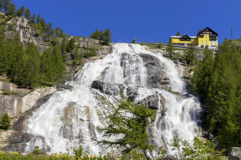
But the Toce Waterfall is the real protagonist here, from where the Toce River springs with a foaming 145-meter drop at an altitude of 1,657 meters and 80 km to the south flows gently into Lake Maggiore. The waterfall is 6 km away from Formazza, an ancient village of Walser origin. In the twelfth century, a group of farmers of German origin, hailing from Canton Valais settled peacefully here, adapting to the harshness and the rules of the mountain.
The Formazza Valley offers charming panoramic views and develops across large slopes that host a great variety of alpine fauna and flora, with utterly unique specimens!
Nearby, the Premia Spa Center, a modern facility with indoor/outdoor swimming pools and wellness areas, is a stop not to be missed. The warm waters of Premia, with their healing properties, flow naturally at 42.5° C from Monte Leone.
The Divedro Valley: a mountain area like you do not expect it
The Divedro Valley is located due north of Domodossola, on the right bank of the Toce River, where it receives the Diveria stream’s waters, near Crevola. The Valley divides the Pennine Alps from the Lepontine Alps and geographically ends at the Simplon Pass. The political border is located about 16 km away from the edge of the Valley, therefore most of the Diveria basin is in Switzerland.
The whole Valley, considered as a whole, both in terms of landscape and morphology, with the wild gorges of Gondo, magnificent Simplon Pass, superb Napoleonic road, and colossal railway tunnel, is the most evocative of the Ossola and one of the most interesting from a visitor’s point of view across the entire Alpine range.
The Valley at the beginning develops in a north-west direction and then, almost as an arc, towards the west, and in this stretch, where Varzo rises, the bottom of the Cairasca Valley branches off, which is the only one on the Italian side of the Divedro Valley.
The freeway that runs through the Ossola in the middle section leads quickly through the tunnel that crosses the Colmine, just over 2 km long, to the Divedro Valley and its capital, Varzo. With its 2,200 inhabitants, the town extends over the sunny terraces on the left side of the Diveria River. The “Varzo” name perhaps derives from the Celtic “vargo” which means “opening, widening,” and here, in fact, the Divedro Valley, after the dark and wild gorges of Gondo, widens into a sunny landscape.
From Varzo, passing through the village, take the provincial road that climbs to the north of the town and enters the Cairasca Valley. The Valley, crossed by the stream by the same name, is rich in tall vegetation and chestnut trees. After the first hairpin bends, it is possible to reach San Carlo’s oratory and, a little further on, the chapel of Maulone. The broad-leaf tree forest is replaced by those of conifers: larches, pines, and firs. After a plateau, the road reaches a crossroads: crossing the Cairasca it is possible to reach Trasquera, while continuing along the river it is possible to reach San Domenico.
A few kilometers away from Varzo stands San Domenico with its San Domenico Ski resort dedicated to winter sports, thanks to the modern ski lifts that lead to the beautiful Alpe Ciamporino.
San Domenico is also the starting point of the footpath that leads to the splendid and unspoiled Natural Park of Alpe Veglia, a true natural paradise for families and hikers.
Instead, going along the Sempione state road 33, it is possible to leave Varzo and reach, through the new freeway, the Iselle station. A little further on, the village perched along the road. After going past the Italian customs, the Valley becomes narrow, and in a short time, it reaches the Swiss-Italian border. On the other side of the border, there is the small village of Gondo, with several stores, gas stations, and currency exchange venues. The imposing and square Stockalper tower stands out immediately. Built in the seventeenth century and used as a shelter by travelers passing through the Simplon pass. Gondo rises at the confluence of the Val Vaira, which opens to the left and is crossed by a scenic road. After passing the gorges of Gondo, the road continues to climb up to an altitude of 2,006 meters, where the Simplon Pass is located, from which you can enjoy views of rare beauty.
[Source: prolocovalledivedro.it].
Alta Valle Antrona Natural Park: green and wild expanses
Green and wild stretches of land, peaks that stand out glowing of the seasons’ iridescent colors, and water that creates waterfalls or quiet alpine lakes.
In a valley where the natural environment is still intact, and the traces of human presence are very few, the Park is rich in springs that feed the countless lakes that dot the slopes and valleys.
Lake Antrona was established in 1642 after a dam caused by a landslide; today, it is a hydroelectric basin, but it still has all the charm of an enchanting alpine destination, and it is a popular destination for many excursions.
Heading up, it is possible to reach by foot the lakes of Camposecco, Cingino, and the dam of Campiccioli with its basin.
The small town of Cheggio, at an altitude of 1,497 meters, overlooked by mountains whose peaks reach 3,000 and 4,000 meters, is surrounded by the imposing basin of Lake dei Cavalli.
Nearby: the ibexes of Cingino
In the Antrona Valley, at an altitude of 2,230 meters above sea level, the agile pregnant female ibexes climb in search of salt, dozens of meters above the ground on the artificial wall of the dam of Lake Cingino, with a 90-degree slope. They find it in the cracks of the dam as saltpeter. The surrounding habitat and high-altitude pastures where the herbivores spend the summer are particularly suitable for breeding, but the grass lacks salt. The nature of the ibex’s hooves is the peculiarity that makes all this possible: they are wide and flexible, with an adipose pad on the bottom that grips the rock like a tong. This spectacle, unique in the world, with the wild mammals typical of the alpine range as protagonists, is a jewel that can be seen and enjoyed after a walk of almost four hours along the “Strada Antronesca,” an ancient road that connected the Ossola with the Swiss
Valais Canton, passing through the valleys of Antrona and Saas. The ibexes are not afraid of visitors and approach in groups of 3 or 4, up to a maximum of about fifteen.
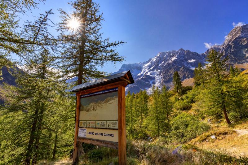
Anzasca Valley: the beauty and majesty of Monte Rosa
The Anzasca Valley extends for 30 km due west of the Ossola Valley with a difference in altitude of more than a thousand meters. It ends with Monte Rosa, a magnificent massif whose peaks rise to a height of 4,634 meters above sea level, creating unique scenery in the Alps.
Its name is given because, at dawn and sunset, the peaks are tinged with pink, reflecting the sun’s color.
The many peaks that exceed an altitude of 4,000 meters make Monte Rosa extremely attractive from a mountaineering point of view. The east side, which overlooks Macugnaga, is considered a real Himalayan wall with more than 2,000 meters of ice, snow, and rock.
Macugnaga, called the “Jewel of Mount Rosa” is the most popular destination of the Anzasca Valley. Its first settlements date back to the mid-thirteenth century. At that time, the monks were the promoters of the first exhibition near the church. Still today, Macugnaga represents the commercial center of the entire Valley.
The Walser left an indelible mark in these mountains and handed down their history, customs, and traditions until now. These mountain people came from the high German Valais. Between the thirteenth and fourteenth centuries, a critical migration gave life to the first medieval alpine settlement. The traces of their settlement are particularly evident in Macugnaga, in the well-preserved Walser village and the Walser House Museum, where it is possible to discover the harsh living conditions of people who knew how to adapt to the harsh mountain environment.
Macugnaga is also a destination for skiers in winter and mountaineers, hikers, and nature lovers in summer.
The Guia Mine, located in Borca, deserves a visit: it is a 1.3 km long mine-museum where it is possible to live the history of a tough job, learning the techniques and procedures of gold extraction and see the ancient tools used for it.
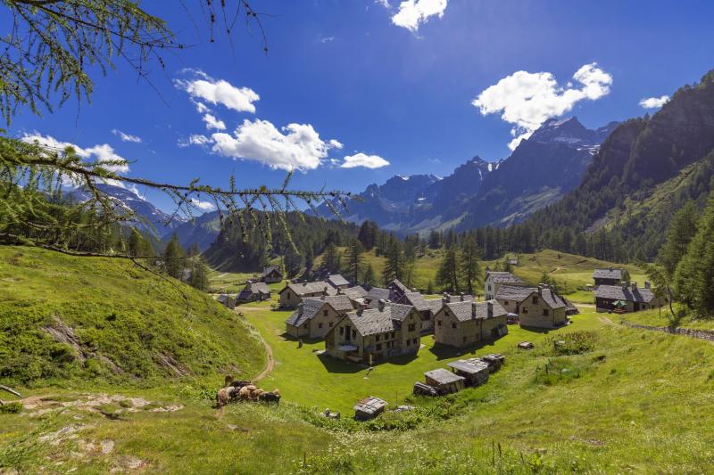
In the Alpe Veglia-Devero Natural Park: ancient alpine pastures protected in a Natural Park
In the Alpe Veglia-Devero Natural Park, in an alpine environment, gentle and harsh, it is possible to admire a landscape made of majestic peaks surrounding alpine pastures, vast meadows, and luxuriant blooms.
In the Alps’ heart, it is a natural park of rare beauty, an unspoiled paradise for alpine vegetation and fauna.
More than 60 trails, easy or challenging, offer the possibility to immerse oneself in the enchanted atmosphere of the Park and connect the Piana del Veglia, reachable by a hiking trail from the tourist resort of San Domenico di Varzo and Alpe Devero.
The natural environment is characterized by vast pastures surrounded by larches, with undergrowth of rhododendrons and blueberries, which fade into high altitude prairies. The great variety of environments boasts the presence of numerous floral and wildlife species of great naturalistic interest.
Many are the typical venues in the mountain pastures of Devero for tasty snacks and meals.
