A charming circular path through various different mountain landscapes, from lush shady woods to open meadows.
Departure and arrival location: San Bernardo (1630 m)
Maximum altitude: 2016 m
Difference in altitude: 500 m total
Distance: 9 km total
Walking time not counting stops: 3 hours and 30 minutes total
Type of route: mixed (trail, asphalt, dirt road)
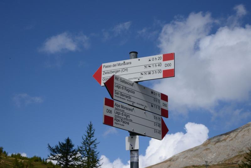
Signs: red/white “D00” “D08” signs, wood signs and red/white marks
Water: fountains in San Bernardo and at Rifugio Gattascosa
Recommended period: this tour is ideal from June to October. It can also be done during winter, after contacting Rifugio Gattascosa to get information about conditions on the trail in case of snow (the trail takes twice the time to complete if there is snow).
How to get there: 20 km away from Domodossola. After reaching Bognanco, take a narrow road to the Oratory of San Bernardo (drive carefully). There is a large parking area after the church, in front of Rifugio San Bernardo. By bus: Domodossola-Bognanco line (www.comazzibus.com)
Information: Distretto Turistico dei Laghi www.distrettolaghi.it; Tourist office – Via Cavallini, Bognanco Terme, tel. +39 0324 234127 www.valbognanco.com; Municipality of Bognanco www.comune.bognanco.vb.it; Rifugio San Bernardo - tel. +39 338 7884574; Rifugio Gattascosa - tel. +39 328 3151669, www.rifugiogattascosa.com; Rifugio Il Dosso - tel. +39 348 8678958
the itinerary
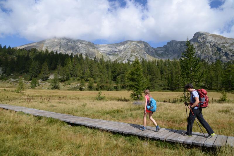
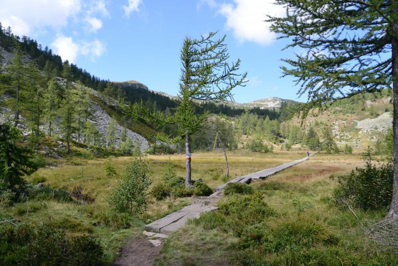
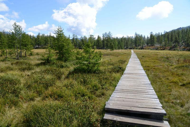
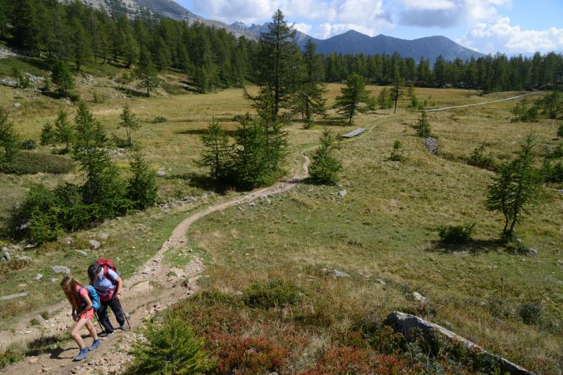
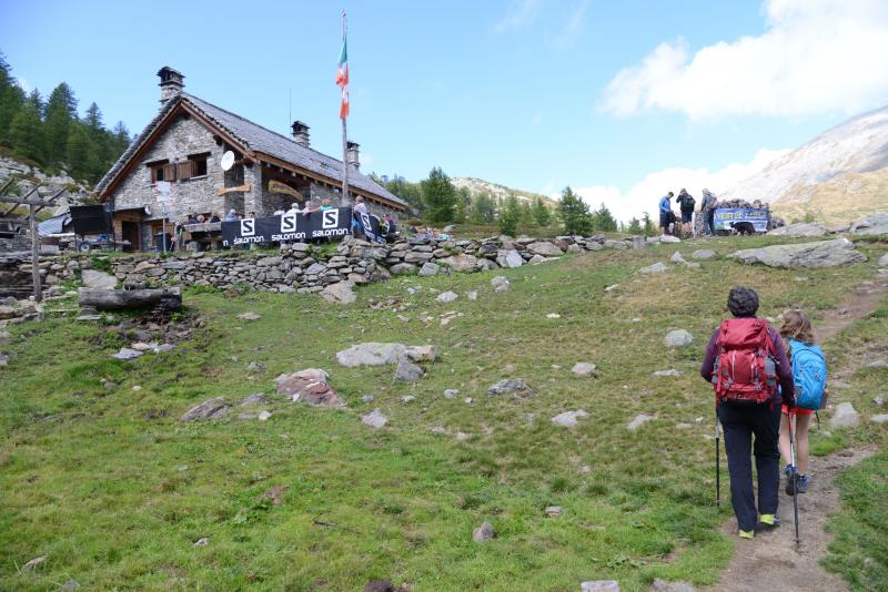
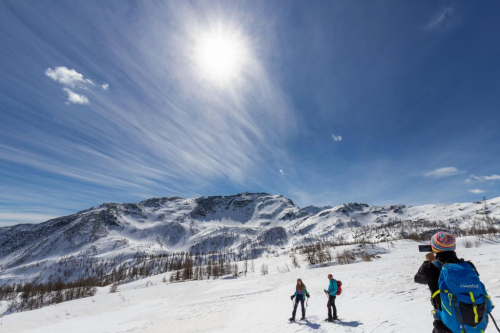
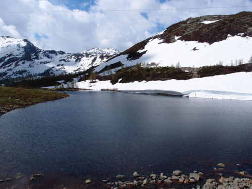
From the road, go past the white oratory dedicated to San Bernardo (with its fountain and pleasant picnic area) and bear left to reach the first refuge in our itinerary: Rifugio San Bernardo, at 1630 m a.s.l. (with rest rooms). Our itinerary begins right next to the parking area entrance (sign for Lake Ragozza). It climbs steadily on a trail that starts out stony and then softens, but always stays in the shade, under leafy larch trees. A sign points towards Lake Arza. This lake lies to the left, but is difficult to reach, so it is better to not leave the path to look for it. Go forward, up the hill, towards the bog "Torbiera di Gattascosa", which can be crossed on wooden walkways. Children love to walk on these types of structures, so they will really like this part of the path! This segment of the trail looks a bit like the Far North: it almost feels like walking the legendary Kungsleden, the “King’s Trail” in Swedish Lapland. The last part of the climb leads to the lovely Lake Ragozza (1960 m): set like a jewel between the steep rock walls, the lake is bordered with rocks to sit on and rhododendrons. The path continues beyond the lake on the right, climbing gradually to Rifugio Gattascosa (2000 m) in a short time. Hikers can enjoy a breath-taking view of the valley that they have just walked through (water fountain). After passing in front of the building, take the dirt road to reach the highest point of the itinerary, which is also the location of a fork with a trail leading off to the left.
Note: our trail goes straight along the dirt road, but, if you like, you can take that trail and, in just over 30 minutes, go up to the Monscera Pass and Lake Monscera (2103 m in altitude; a difference in altitude of +100 metres, another 1.7 km, about 40 minutes longer than the itinerary described here), where you can admire the beautiful peaks of Canton of Wallis, Switzerland.
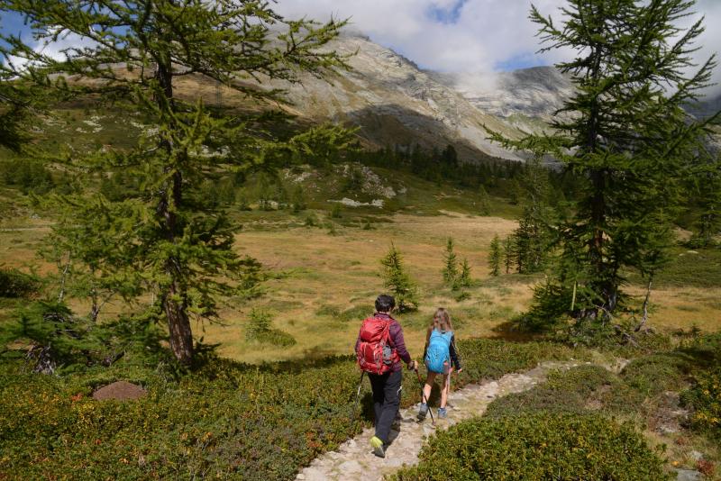
Now, you have two options: simply follow the dirt road and make a wide curve around a humid pasture area, or take the trail on the right to cut straight through it. After getting back on the dirt road, follow it downhill. You will pass next to Alpe Monscera and then go towards a panoramic memorial, continuing downhill on the dirt road. Take a moment to look closely at the strip on the lower part of the memorial. It is in metal and decorated with figures of travellers... People that you will meet here and there on the next trail! The dirt road becomes steeper, turns into asphalt and passes near a second village, Arza (water fountain). Then we come to the third refuge on this itinerary: Rifugio Il Dosso (1740 m). After the building, the road descends steeply in a few hairpin turns. You will cross a bridge, and then the road will level off before you get to Rifugio San Bernardo, your starting point.
Tips for young hikers
A long but easy walk. The dirt road from San Bernardo going straight to Rifugio Il Dosso and then to Rifugio Gattascosa is suitable for pushchairs. Allow a lot more time for this path due to the many stops at the lake and at the refuges.
Trail creators: Franco Voglino, Annalisa Porporato and Nora Voglino
Content authors: Franco Voglino and Annalisa Porporato