Grandiose loop hike around La Cima, for a panoramic walk in the presence of the snowy peaks of Val Grande and Monte Rosa
Place of departure and arrival: Piana di Vigezzo, upper station of the cableway (1726 m)
Maximum altitude: 1740 m.
Height difference: +200 m approx. in total (not continuous)
Distance: 3 km in total
Travel time net of stops: 1 hour 30 minutes in total
Signage: white/red "Colma di Fuori" "Colma di Dentro" signs - MTB signs
How to get there: 18 km from Domodossola. Strada Statale 33 del Sempione exit Masera. Follow the signs for the Valle Vigezzo State Road 337 to the municipality of Santa Maria Maggiore and take the direction of Craveggia, Loc. Prestinone - Piana di Vigezzo.
The itinerary:
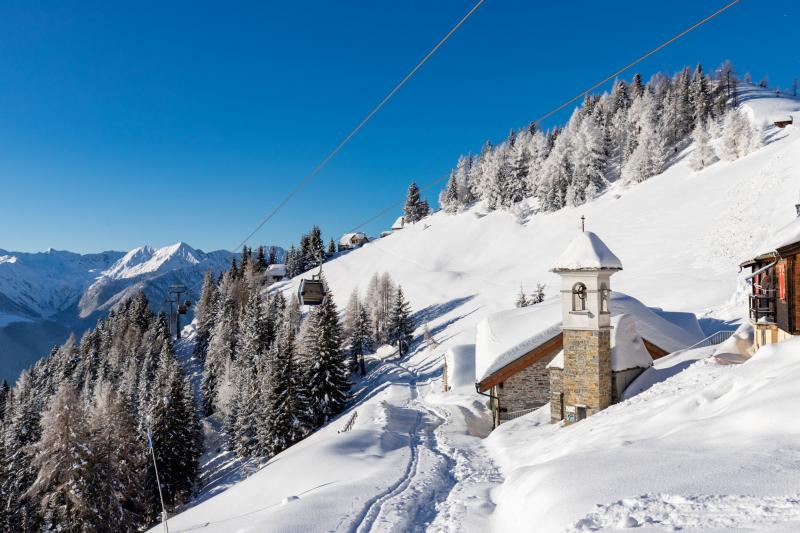
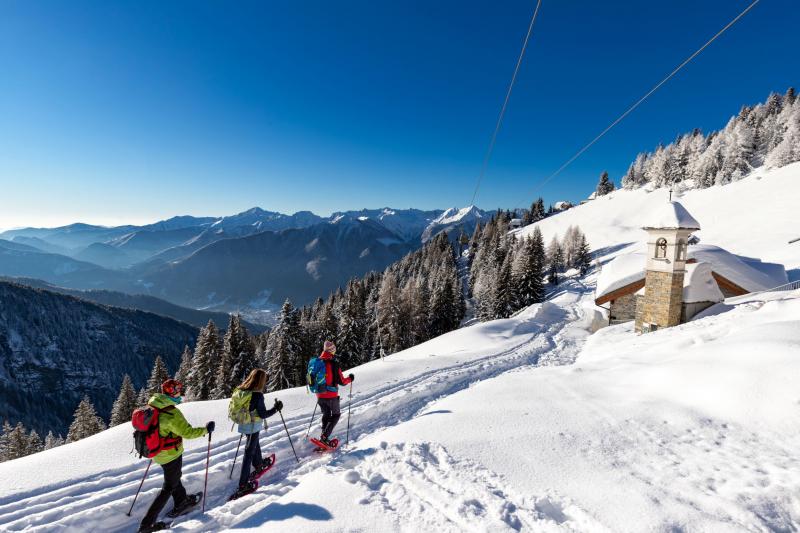
You can take the cable car from Fraz. Prestinone di Craveggia to Piana di Vigezzo, once you come out on the snow, turn right around the building to take the track that goes slightly downhill below the cable car cables and leads to a beautiful little church.
The track is clearly visible and continues on a slight slope, heading directly towards some houses, which are already visible. Once they are After reaching them, turn right, passing just above the small village and continuing on a track that is now less beaten but still visible (signpost "M25 Colma di Fuori"). The route continues in a gradual way, without forks, with panoramic views to the left over Val Vigezzo and the main peaks of Val Grande, although it often remains among the trees. When you reach an open area you also arrive at the first fork.
On the left, below, you can see an alpine pasture: on the right, a steep path leads to La Cima while our route continues straight ahead, on a flat stretch (signpost "Colma di Dentro").
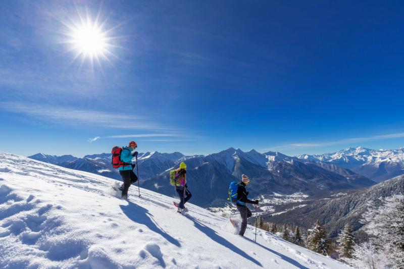
Before continuing, it is obligatory to stop and admire the panorama that embraces, among other peaks, the Monte Rosa Massif (4634 m).
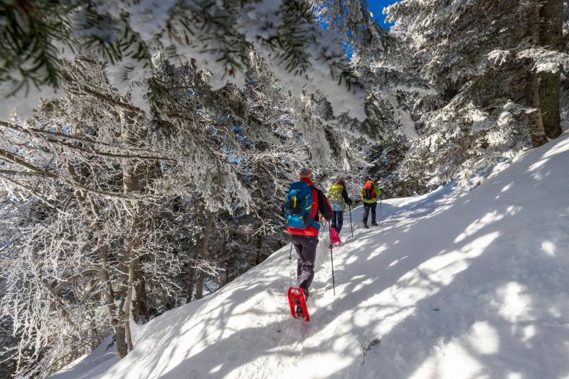
The route now continues through denser forest. Shortly after this crossroads you will come to the only fork: keep to the left, slightly downhill (just before a small MTB sign). Go round the entire ridge, returning to the sun and easily reaching some scattered huts in Colma di Dentro.
Go in the direction of the nearest lift pylon, where there are some red/white signs; do not take any of these signs but take the gradual, unmarked track that continues on the same level.
The route is now narrower and less scenic than the previous one, but still suggestive. It continues gradually and without forks, this time offering glimpses in the direction of Cima Trubbio, passing below the cables of the chairlift that reaches Cima 2, visible by looking up to the right.
When the trail briefly steepens, it comes out at the edge of the track coming from Cima 2. Pay attention and cross it going back to the cable car station.
Tips for baby snowshoers
Easy hike, free of height differences and difficulties, also suitable for younger children. At the scenic crossroads, wide plateaus open up where you can linger and slide, just as at Colma di Dentro.
In certain snow conditions, the grooming of the trail makes the route feasible even without snowshoes. Better equip yourself with a map or a specific app to recognise the numerous peaks visible during the hike!
CONTACTS FOR TOURIST INFORMATION
PIANA DI VIGEZZO
Via Carlo Fornara Pittore 13 – 28852 Fraz. Prestinone di Craveggia (VB)
Tel. +39 351 6333560 / +39 345 8587040
Email: info@pianadivigezzo.it
www.pianadivigezzo.it
Itinerary makers: Franco Voglino, Annalisa Porporato e Nora Voglino
Authors of the text: Franco Voglino, Annalisa Porporato
The path is described in the book “SNOW TREK” of Distretto Turistico dei Laghi – edition 2021
The routes were suggested by ski operators and municipalities Partner of Neveazzurra project. We decline any responsability regarding the effective feasibility and any changes that the routes can suffer. Maps and tracks are purely indicative of the route.
Safety annotations:
Here are some practical tips: find out about weather and snow conditions, checking the forecasts especially at local level; check the avalanche bulletin for the relevant area; equip yourself with and carry PSA self-rescue equipment: shovel, probe and ARTVa; wear warm, waterproof clothing that is comfortable and consists of several layers... despite the snow, you will get warm as you move; hiking shoes or mountain boots depending on the area, terrain and altitude where the hike takes place; bring gloves, cap, sunglasses and sunscreen; pack a rucksack with a spare shirt and hot drinks; during the hike, always check the slopes above you; avalanches usually break off on slopes with a gradient of more than 25° and can also continue on flat sections.