An easy hike of great satisfaction in a magnificent environment, to make even the less sporty fall in love with snowshoes
Place of departure: Baceno, Alpe Devero car parks (1620 m.)
Place of arrival: Crampiolo (1767 m.)
Height difference: +150 m one way
Distance: 1.5 km one way
Travel time net of stops: 45 minutes one way
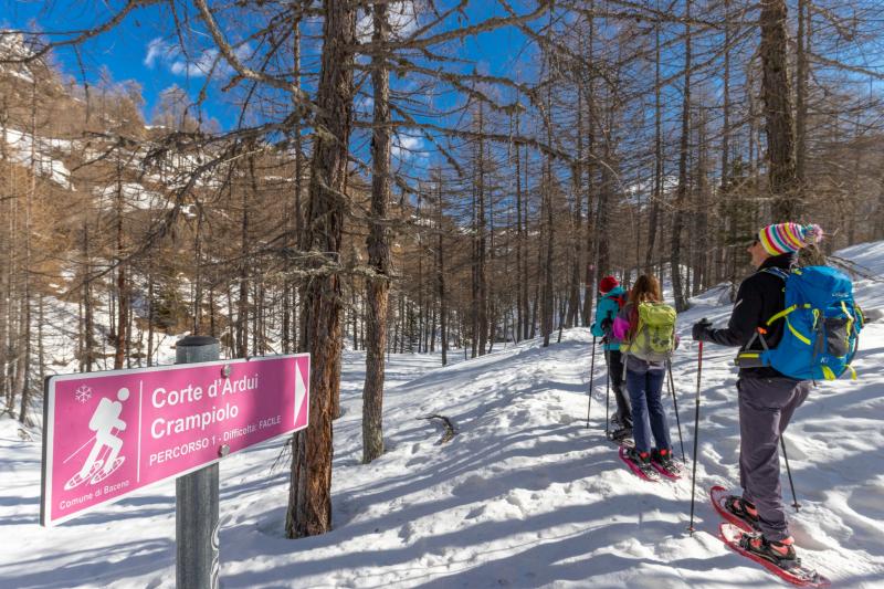
Signage: pink diamond "route 1" signs
How to get there: 31 km from Domodossola. Strada Statale del Sempione 33, Crodo exit. Follow the signs for Baceno/Val Formazza; once in the centre of Baceno take the municipal road up to Devero (about 7 km).
The itinerary:
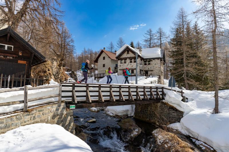
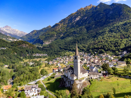
Climb up the snowy road that leads from the car parks towards the small white church of Alpe Devero, Ai Ponti district. Just behind it, cross the bridge on the right and pay attention to the white house right next to it: next to the window you can see the snow depths reached in 1951 and 2009: impressive!
After a few steps, turn right (signpost) to reach the second bridge, after which you must keep to the left, going slightly uphill as the track becomes a path.
The route, well-marked by the diamonds that are placed very high up in the trees and visible from afar, climbs steadily and continuously, very gradually with a few steeper sections. Keep along the Devero stream, which initially runs through narrow gorges, and then move slightly away from it (always keep along the diamond marked track and do not follow the white/red summer signs), always in the thick of a peaceful larch wood. After passing some houses that are a little hidden on the left, you return to the stream. Pay attention to the steep slopes to the left. As they are very exposed, they are the first to be cleared of snow and, if you are lucky, you may spot a deer crossing.
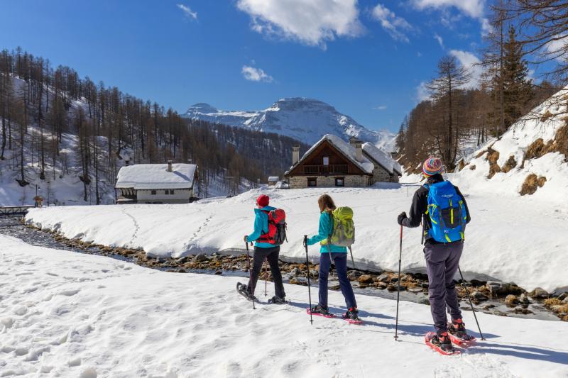
The route leads to the junction with route number 3, which should be ignored, and soon afterwards the clearing where the Corte d'Ardui houses are located appears. A short, almost flat stretch leads to Motto di Crampiolo, with a small votive pillar. The trail veers sharply to the left and leads to the bridge that allows you to cross the stream, taking you onto what is a dirt road in summer.
Attention: The dirt road between this point and Alpe Devero, on the left, is closed in winter and should NOT be used under any circumstances because of avalanche risks!
Turning right, walk on a level path towards the houses of Crampiolo, all of which are very well restored in stone and wood. Cross the bridge and walk along the stream for another stretch to reach the pretty little white church.
The return journey is by the same route as the outward journey.
Alternatively, there is a ring of similar length. From the little church, continue to the bridge and cross the stream; then take the obvious beaten ski track on the left that leads back to Alpe Devero, passing through the villages of Vallaro and Cantone. On this route, it is imperative to avoid turning towards Lago delle Streghe (Witches' Lake) as it is in an area that is often exposed to avalanches.
Tips for baby snowshoers
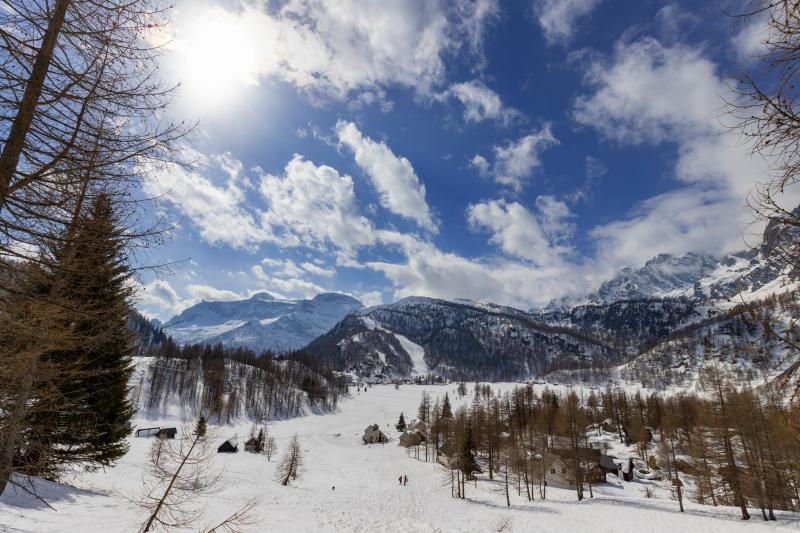
An easy hike through open and at the same time suggestive environments, among larch forests, clearings and isolated houses. The snow-covered village of Crampiolo is magnificent, while the open surroundings are an invitation to play and relax.
A hike suitable for everyone, perfect for beginners.
CONTACTS FOR TOURIST INFORMATION
PRO LOCO OF BACENO
Via Roma, 56 - 28861 Baceno (VB)
cell. +39 377 6789038
Email: prolocobaceno@libero.it
COMUNE DI BACENO
Via Roma, 56 - 28861 Baceno (VB)
tel. +39 0324 62018
protocollo@comune.baceno.vb.it
www.comune.baceno.vb.it
Path makers: Franco Voglino, Annalisa Porporato e Nora Voglino
Authors of text: Franco Voglino, Annalisa Porporato
The path is described in the book “SNOW TREK” of Distretto Turistico dei Laghi – edition 2021
The routes were suggested by ski operators and municipalities Partner of Neveazzurra project. We decline any responsability regarding the effective feasibility and any changes that the routes can suffer. Maps and tracks are purely indicative of the route.
Safety annotations:
Here are some practical tips: find out about weather and snow conditions, checking the forecasts especially at local level; check the avalanche bulletin for the relevant area; equip yourself with and carry PSA self-rescue equipment: shovel, probe and ARTVa; wear warm, waterproof clothing that is comfortable and consists of several layers... despite the snow, you will get warm as you move; hiking shoes or mountain boots depending on the area, terrain and altitude where the hike takes place; bring gloves, cap, sunglasses and sunscreen; pack a rucksack with a spare shirt and hot drinks; during the hike, always check the slopes above you; avalanches usually break off on slopes with a gradient of more than 25° and can also continue on flat sections.